Canadian Rockies Lake Trails: Looking Beyond the First View
A mountain lake can seem like a destination completed in a single glance, yet the most rewarding visits usually begin after the first photograph. A shoreline path, a quieter bend, or a place to sit can reveal the relationship between water, forest, and surrounding slopes.
A different way to arrive
A mountain lake can seem like a destination completed in a single glance, yet the most rewarding visits usually begin after the first photograph. A shoreline path, a quieter bend, or a place to sit can reveal the relationship between water, forest, and surrounding slopes. In the Canadian Rockies, that slower approach also requires practical planning. Access arrangements, wildlife, weather, and trail conditions should shape the day before the color of the lake shapes the expectations.
Choose the park and the lake together
The Canadian Rockies extend across a large region, and a list of famous lakes can conceal considerable driving. Begin with the park and the base you are actually using. A nearby lake with an appropriate trail may offer a richer day than a long transfer to a more recognizable view. Consider whether you want a short shoreline outing or a substantial hike to another basin. These are different plans with different preparation.
Use the relevant park authority’s current information to compare access and trail requirements before arranging the day around a particular lake.
Treat access as part of the itinerary
Some popular lake destinations use specific transport, parking, reservation, or seasonal access arrangements. These can change, so check official information directly and avoid relying on an older account. Knowing how to arrive is only half the plan; the return connection and any time limits also matter. A confirmed access arrangement should leave enough time for a comfortable walk rather than a rushed visit between transfers.
Keep booking details accessible offline where possible and identify an alternative destination if the required access cannot be secured.
Distinguish shoreline paths from mountain trails
A path near the water may be relatively straightforward, while a trail continuing beyond it can gain height, cross rough ground, or enter more exposed terrain. Read the full route description rather than following other walkers beyond the original plan. Distance, elevation, surface, and current conditions all matter. A partial shoreline walk can offer a satisfying experience without turning into an unplanned hike. Take the descent and return time seriously.
Choose a clear turnaround point before leaving the arrival area, and change that point only after reassessing the group and conditions.
Let the lake change as you move
Mountain water can look different with light, wind, depth, and suspended sediment. The exact color in a photograph is not a condition a real landscape must meet. Walk to a permitted point along the shore and look back toward the arrival area. Reflections, forest edges, and the shape of the mountains may become more interesting than the original viewpoint. Stay out of restricted areas and do not climb barriers for an unobstructed image.
Use public paths and durable stopping places, allowing other visitors access to the same view rather than occupying a narrow photo position indefinitely.
Follow wildlife guidance before an encounter
The Rockies are wildlife habitat, including areas used by large animals. Read and follow the park authority’s current wildlife guidance, including recommended preparation, group practices, restrictions, and appropriate equipment. Do not approach or feed animals. A sighting should never become a reason to leave a trail or gather around an animal’s route. Temporary closures and group-size requirements, where posted, must be followed.
Learn the relevant official procedures before walking and keep food and belongings managed according to park instructions throughout the visit.
Prepare for mountain weather
A sunny parking area does not settle conditions along a trail. Rain, wind, cold, snow, and changing visibility may affect the route depending on season and elevation. Consult current forecasts and trail reports. Carry suitable layers and equipment, and avoid assuming a popular destination requires little preparation. If the route crosses terrain with additional seasonal hazards, choose a safer alternative unless you have the appropriate knowledge and preparation.
Keep a lower-demand outing available and reassess the plan before leaving the last easy point of return.
Keep food and pauses low-impact
A lakeside break is appealing, but it should take place where permitted and in a way that protects wildlife and vegetation. Carry food securely, pack out waste, and follow the park’s rules for storage and eating. Do not use fragile shoreline plants as a picnic mat or feed birds for a photograph. Busy areas may require a short wait for a suitable place to stop. Patience helps keep the shore enjoyable for everyone.
Bring enough supplies for the planned walk while leaving no food scraps, wrappers, or other traces behind.
Finish with the return already understood
The last stretch should not be a race to a shuttle, a dark drive, or a closing facility. Set the turnaround with the actual return arrangement in mind. A short walk enjoyed calmly can leave a stronger impression than a longer one dominated by time pressure. Before leaving, look once more at the relationship between the lake and the mountains rather than searching for a final perfect photograph.
Allow a buffer for the return journey and keep the evening plan close enough that the lake visit remains the day’s focus.
Three lakes are three separate decisions
Lake Louise offers a clear example of the difference between a shoreline outing and a mountain hike. The lakeshore path allows a visitor to experience changing views along the water, while routes continuing into higher terrain introduce additional distance, ascent, and conditions. Read the relevant Parks Canada descriptions and decide on the intended route before starting. The familiar view from the arrival end is only one perspective, but seeking another angle does not require an ambitious hike. A modest out-and-back walk can be the right choice when transport, weather, or the group’s energy limits the day.
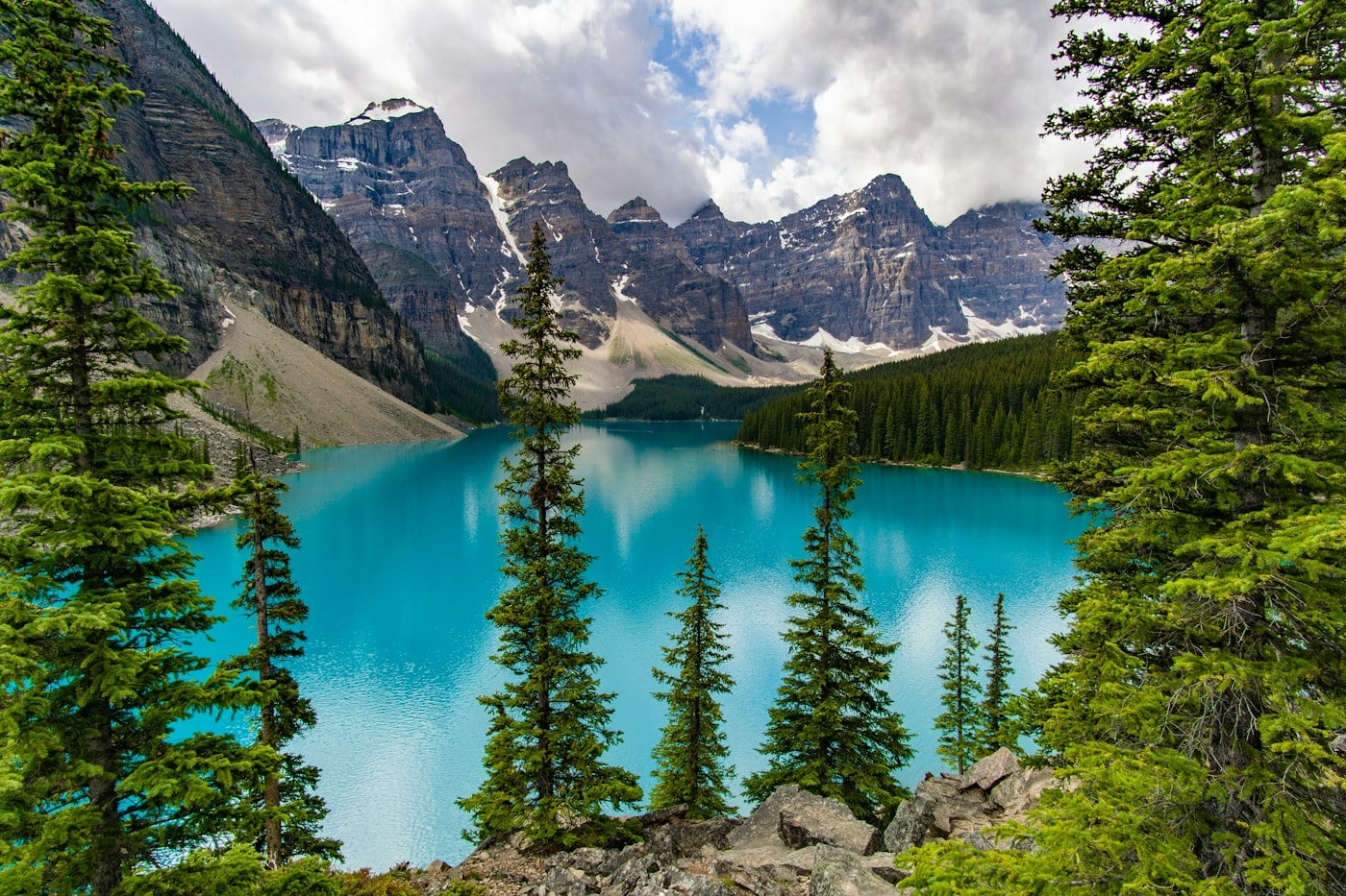
Moraine Lake has its own access arrangements and trail choices. Do not assume that a plan used for Lake Louise transfers directly to this destination. Check current official transport information, reservations where required, and trail reports. The well-known mountain backdrop can create a sense that the visit must happen at a particular photographic moment, yet the practical plan should come first. A permitted shoreline walk and a calm pause may be more rewarding than attempting another route under time pressure. Wildlife-related restrictions can apply to surrounding trails, and posted requirements must be followed rather than treated as optional advice.
Emerald Lake in Yoho National Park provides a different park setting and should be planned through the relevant official information. It is not simply another lake to add automatically after a full Banff day. Consider the driving, the walking route, and the return before deciding whether it belongs in the same itinerary. A separate outing may allow more attention to the forest edge and the relationship between the water and surrounding slopes. Comparing these lakes over several days can be instructive, but the comparison should be about landscape and experience rather than ranking water color. Weather, light, and wind can make each visit look unlike a familiar image. The most useful plan gives each selected lake enough time to become a place rather than a name, while leaving other destinations for a future trip.
Lake destinations also differ in the services available at their arrival areas. Do not infer food, drinking water, toilets, or indoor shelter from the popularity of a photograph. Check the official visitor information for the exact place and season, then carry supplies appropriate to the plan. A shuttle stop and a trailhead are transport or access points, not a guarantee of every facility. This matters when traveling with children or anyone who needs frequent comfortable breaks. Keep the walk’s length within what the available arrangements support, and leave room to return early if the day is less comfortable than expected.
Make the famous view only the beginning
Arrival at a well-known lake often creates a moment of urgency: people gather at the first clear view, cameras come out, and the scene can feel like something that must be captured immediately. Step aside where permitted and let that moment pass. Once the initial crowd has moved, look at the wider setting and identify the start of the chosen path. You do not need to compete for the exact composition seen online. A different angle, a changing reflection, or the forest at the edge of the water can provide a more personal memory without requiring access beyond public areas.
The walking plan should remain independent of the photograph. Follow the route selected from official information, reassess the group at the agreed turnaround, and keep enough time for the return connection. If weather changes or a closure affects the trail, the shoreline visit may still be complete in itself. Do not continue into unfamiliar terrain simply because the lake has already required effort to reach. Access arrangements, travel, and walking all consume energy, and the final shuttle or drive deserves attention too. A good plan leaves a margin that is still present at the end rather than using every available minute.
For another day, consider a less demanding lake outing near the base rather than pursuing the next famous destination at any cost. The comparison can reveal how different basins, forest edges, and mountain shapes affect the experience. Current wildlife guidance and trail reports remain important even where a place is less crowded. Quiet does not mean unregulated or free of hazards. Bring the same care to food, waste, route choice, and respectful observation. The Canadian Rockies are not a collection of interchangeable blue-water images. Their appeal grows when each lake is understood as part of a living mountain landscape with its own access, conditions, and scale.