Walking Between Huts in the Dolomites: How to Plan a More Enjoyable Mountain Day
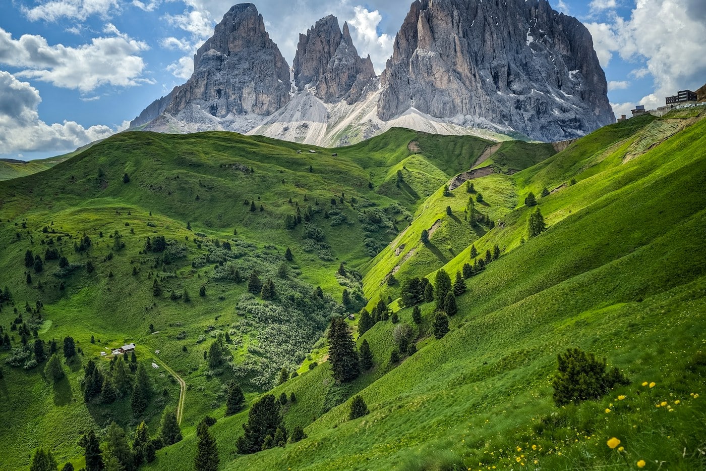
The Dolomites can make a simple walk feel visually immense. Pale rock towers rise above pasture, trails cross open slopes, and mountain huts provide a human scale within the landscape.
A different way to arrive
The Dolomites can make a simple walk feel visually immense. Pale rock towers rise above pasture, trails cross open slopes, and mountain huts provide a human scale within the landscape. Those inviting scenes still belong to a serious mountain environment. A rewarding hut walk begins with a route that matches the group and the conditions, not with a photograph of a terrace. Choose the walking first, then let a suitable hut become the pause that gives the day its shape.
Choose a valley before a famous name
The Dolomites cover a broad mountain area, with different valleys offering different access, languages, and trail networks. A route near your base is often more enjoyable than a long morning transfer to a famous viewpoint. Study the local map and identify the actual trailhead, elevation gain, and return connection. A hut name alone says little about how difficult the approach will be. Two routes to the same building can have very different demands.
Choose a valley-specific official map and compare the whole route, including the descent, before committing to a particular hut.
Read distance together with ascent
Mountain distance is not the same as distance on a city pavement. Steep ascent, rough ground, exposure, and navigation can change the time and effort involved. Look at elevation gain and the nature of the trail, then consider the slowest member of the group. Posted times are useful references rather than guarantees. A short route with a long, awkward descent may be less suitable than a longer walk on straightforward terrain.
Select a route with a comfortable margin and a turnaround point that can be used before the hut if progress is slower than expected.
Know what kind of trail you are choosing
A maintained hiking path, an exposed mountain route, and a via ferrata are not interchangeable experiences. Do not let an attractive hut photograph obscure the approach. Read current official route descriptions and ask qualified local professionals when the terrain or required equipment is unclear. Snow, rockfall, damaged sections, and seasonal closures can alter a familiar path. A route that suits someone else’s experience may not suit yours.
Avoid technical terrain beyond your skills, and treat any uncertainty about exposure or equipment as a reason to choose a different walk.
Use the hut as a pause rather than a promise
A mountain hut can offer food, shelter, or accommodation, but services and opening seasons vary. Check directly before relying on it for the day. Carry what you need for your own route instead of assuming every facility will be available. When a hut is open, follow its routines around footwear, bags, ordering, and waste. The terrace is a shared place where other walkers may also need rest.
Bring sufficient food and water for the plan and reserve overnight accommodation directly when a multi-day route depends on a particular hut.
Build the day around changing conditions
Mountain weather can change the character of open slopes quickly. Consult current local forecasts and official advisories, and understand how the chosen route behaves if cloud, rain, wind, or storms arrive. A morning decision does not settle the whole day. Reassess at junctions and exposed sections. Turning around early can preserve an enjoyable outing rather than convert it into a race against worsening conditions.
Keep a simpler walk in the same valley as an alternative, and do not use a hut reservation as a reason to continue into unsuitable weather.
Pack for stopping as well as walking
The view from a terrace encourages a long pause, but a warm uphill climb can be followed by a cool, windy rest. Suitable layers, weather protection, navigation, a charged phone, and appropriate footwear should match the route and season. Carry a local map rather than relying entirely on a single screen. Reduce unnecessary weight, while keeping essential supplies for the mountain environment.
Check the complete route with the group before leaving, and ensure that someone outside the party knows the intended plan when appropriate.
Share pasture and trail carefully
Many appealing hut approaches cross managed pasture and working landscapes. Follow signs, close gates as instructed, keep a considerate distance from livestock, and avoid disturbing animals for photographs. Stay on designated trails rather than cutting corners across fragile ground. Other walkers may be ascending slowly or descending with tired legs. A brief patient pause at a narrow section is part of sharing the route.
Carry all litter back unless a facility explicitly accepts it, and keep noise low enough that the landscape remains enjoyable for others.
Let the descent remain part of the walk
The hut is often the midpoint, not the finish. Descending can demand sustained concentration, especially on loose surfaces or when legs are tired. Leave enough energy and daylight for the return, and verify lift or bus arrangements if the route depends on them. A beautiful long lunch should not make the descent rushed. Pause in safe places to enjoy the view instead of looking up continuously while moving.
Set a departure time from the hut before sitting down and keep the return route as carefully planned as the outward leg.
Two landscape settings to compare before choosing
Alpe di Siusi, also known as Seiser Alm, is a useful area to investigate for walks through an open pasture landscape beneath Dolomites rock formations. Its appeal does not mean every route is equally simple. Compare the official trail options, access arrangements, and the complete elevation profile. A broad landscape can still involve sustained ascent, exposed weather, or a longer return than expected. Choose a route that suits the group rather than assuming a meadow setting removes the need for mountain planning. Huts can give the walk structure, but their current opening and services must be checked directly.
Val Gardena offers another important regional frame, with several settlements and access points into surrounding mountain areas. Ortisei, Santa Cristina, and Selva di Val Gardena are not interchangeable trailheads, so identify the actual start and return before arranging accommodation or transport. Names may appear in more than one local language, and matching the route name on a map with the signs on the ground is worth doing carefully. If a lift is part of the plan, its current operating information becomes a practical constraint. Do not let the last descent depend on an assumed service that has not been confirmed.
The Dolomites also include routes whose fame can obscure their seriousness. A high traverse, a summit approach, or a via ferrata should not be added to a hut day simply because it appears nearby. The proper comparison is between terrain, experience, equipment, and conditions. Seek qualified local advice where necessary and choose an ordinary walking alternative when that is the better fit. At a hut, regional food can be a pleasant part of the experience, but menus and availability vary. Decide on the return departure before ordering so that the meal remains relaxed. The landscape is large enough to support many future walks. A first outing that clarifies which terrain you enjoy and how the group moves together provides more value than an overextended day built around one celebrated mountain name.
Local place names can be an important practical detail in this region. A hut or settlement may appear with Italian, German, or Ladin forms depending on the area and the information source. Match the destination on the official map to the signs and any booking confirmation before leaving. Do not assume that two similar names identify the same building or trail junction. A photograph of a route sign can help with later reference when taken from a safe stopping place. Clear naming is especially useful if the day involves a lift, a bus, or a reserved overnight hut, because the correct endpoint matters as much as the scenery along the way.
A single-hut day before a multi-day ambition
For an introduction to Dolomites hut walking, a day route to one suitable hut can teach more than an immediately ambitious traverse. Choose the trail for its complete terrain and return, verify current conditions, and establish a turnaround time before leaving. The hut then becomes a useful pause rather than the justification for continuing. On arrival, follow its procedures and allow the group to rest without losing track of the descent. Check how everyone feels before deciding whether the planned return still makes sense. A generous lunch break should fit within the day’s margin, not consume it.
If the idea of an overnight route remains appealing, plan it as a separate project. Reservations, route links, equipment, weather alternatives, and the ability of the whole group need careful consideration. Do not assume that experience on one easy approach establishes readiness for a more exposed connection between huts. Read official descriptions, speak with appropriate local professionals, and choose a conservative itinerary. A multi-day trip introduces additional decisions about what happens if a route closes or the weather prevents reaching the next booking. Those questions are best answered before the journey, while several options remain available.
The visual appeal of the Dolomites can make every viewpoint seem urgent. Resist building the day around chasing them all. A slope seen while walking slowly, the changing shape of a rock tower, or the contrast between pasture and stone can provide a complete landscape experience. Stop only where there is room, remain on the designated route, and let other walkers pass. The mountain does not need to be turned into a sequence of dramatic photographs. A well-chosen walk leaves enough physical and mental energy to notice its ordinary details and to finish the descent carefully. Returning with a clear understanding of your own pace and comfort is valuable preparation for any future trip.