São Miguel at Island Pace: Lakes, Tea, and Atlantic Weather
São Miguel is compact enough to invite an ambitious circuit and varied enough to make that circuit exhausting. Crater lakes, cultivated fields, steaming ground, and Atlantic villages all compete for attention, while cloud can transform a celebrated viewpoint in minutes.
A journey with room to notice
São Miguel is compact enough to invite an ambitious circuit and varied enough to make that circuit exhausting. Crater lakes, cultivated fields, steaming ground, and Atlantic villages all compete for attention, while cloud can transform a celebrated viewpoint in minutes. The most enjoyable plan keeps its shape loose. Choose a few parts of the island, understand the distances between them, and leave room to return when a place first appears through rain.
Use Ponta Delgada as an introduction
Ponta Delgada is more than a convenient arrival point. Its streets, churches, waterfront, and public spaces make a useful introduction to the island’s urban life. Spend time walking before committing to the road, and arrange practical supplies without turning the first afternoon into a long drive. A town-based day is also a useful option when higher viewpoints are obscured.
Use the first town walk to locate ordinary essentials as well as attractive streets. Knowing where you can buy food, collect information, or sit comfortably makes later outings simpler. The waterfront can provide orientation, but give the streets behind it some attention too. Ponta Delgada helps show that São Miguel is not only a set of volcanic viewpoints. A relaxed arrival also creates a better basis for deciding what to attempt next, especially if a journey to the island has left little energy for driving.
Approach Sete Cidades with flexibility
The lakes at Sete Cidades lie within a volcanic landscape whose scale becomes clearer from different levels. A high viewpoint and a village-level walk offer separate experiences. If cloud hides the panorama, explore below rather than waiting indefinitely beside a car park. Use marked routes and official access information, especially when considering a walk along higher ground or crater rims.
At Sete Cidades, a change of level can be more useful than a long wait for the cloud to move. A village-level walk lets you see the lakes as part of a lived landscape, while an official viewpoint explains the larger volcanic form when visibility permits. Do not keep driving around in pursuit of one photograph if the conditions remain unsuitable. Mark the place for a possible return and spend the available time somewhere you can actually see and understand. That is a better use of an island day.
Give Lagoa do Fogo its own conditions check
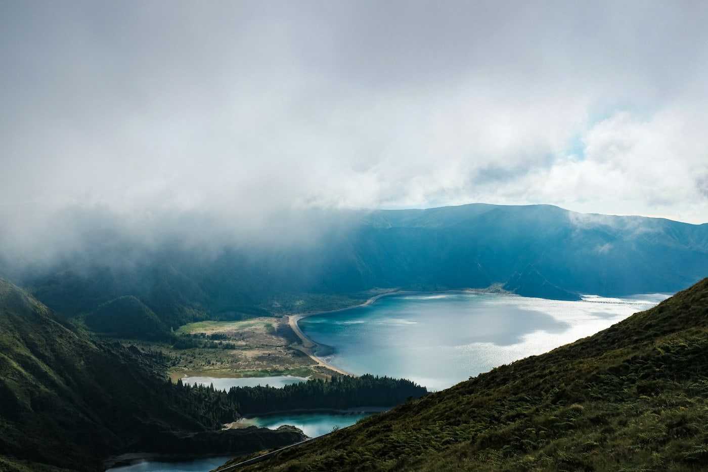
Lagoa do Fogo is not simply another lake to fit between appointments. Weather, visibility, and access arrangements can affect the visit, and protected landscapes deserve particular care. Check the current official guidance before setting out. Choose a permitted viewpoint or route suited to the conditions, and avoid assuming that an informal path is an acceptable way to reach the water.
Check whether current visitor management affects the way you reach Lagoa do Fogo. Arrangements can change, and a general description of the island may not include the details relevant to your visit. Once there, stay within permitted areas and avoid treating protected ground as an open invitation to wander. The lake’s appeal is tied to its setting, including the vegetation and slopes around it. A view from an appropriate place can convey that relationship without requiring a walk down to the shore.
Spend a slower day around Furnas
Furnas brings volcanic activity into close proximity with village life, gardens, and a lake. The area makes more sense as a day with several short visits than as a single photo stop beside steam. Follow marked boundaries around geothermal ground and use facilities only as directed. Distinguish between a public viewing area, a managed garden, and a bathing facility when planning access.
Furnas rewards attention to contrasts: village streets and planted spaces, still water and active ground, a meal and a short interpretive visit. Group these elements into a gentle sequence rather than running between them. Managed gardens and geothermal facilities have their own rules and opening arrangements, so check each separately. Around steaming areas, boundaries are practical instructions, not merely suggestions for crowd management. You can appreciate the landscape’s unusual character while staying on the route designed for visitors and giving other people space to look.
See tea as a working landscape
Tea growing on São Miguel gives the northern landscape a distinctive pattern. A visit to a producer that welcomes the public can connect the orderly fields with the process behind a familiar drink. Check visitor arrangements and stay within the areas open to guests. Fields are workplaces, so a photograph should not require entering rows, interrupting work, or treating production space as a prop.
A tea visit becomes more interesting when you distinguish growing from processing. The fields explain the pattern of the landscape; a welcoming producer may explain how leaves become a finished drink. Ask what parts of the premises are open and whether photography is appropriate. Resist assuming that all visitors can enter production areas simply because the site receives guests. A modest purchase can be a useful reminder of the place, but the visit is worthwhile even when your main aim is understanding rather than shopping.
Choose a coastal interval
A coastal village such as Ribeira Grande offers a change from crater viewpoints. Walk through the center, look at the relationship between the settlement and the Atlantic, and allow time for an ordinary lunch. Ocean conditions deserve attention of their own; a beach that looks inviting from a viewpoint is not automatically suitable for entering the water. Follow local advice and posted restrictions.
A north-coast town can be a natural interval between landscape visits. Park appropriately, walk a compact area, and let a meal anchor the afternoon. If the sea is rough or the weather discourages a longer outing, do not compensate by searching for a more remote beach. Observe the coast from a suitable public place and choose another activity. The Atlantic is a defining part of São Miguel precisely because it has its own conditions; it is not simply a decorative foreground for an island photograph.
Keep the road plan modest
Repeatedly crossing the island to chase clear weather can consume more time than it saves. Group nearby places, identify a low-level alternative, and stop trying to rescue every missed viewpoint. Narrower roads and unfamiliar junctions also make a conservative schedule useful. Ask about rental restrictions and parking before setting off, then leave enough daylight for an easy return.
Build a day from nearby places that offer different experiences. A town, a cultivated landscape, and one viewpoint can work well together because they do not all depend on the same visibility or energy level. Keep the route readable and avoid doubling back repeatedly. Before setting off, know where the final stop is likely to be and how you will return. This leaves room to linger at an unexpectedly rewarding place without discovering that the day’s essential transport has become complicated by the detour.
Let one landscape become familiar
Returning to the same lake, waterfront, or garden can reveal more than another rushed stop. Cloud lifts, reflections change, and a path becomes easier to read once you know where it leads. Keep at least one open half-day for that kind of return. An island itinerary should have enough space for a place to surprise you twice.
A second visit can be deliberately modest. You might return to the same waterfront for a walk or revisit a lake viewpoint because the cloud has lifted. The point is not to correct an imperfect first photograph, but to see how the setting changes. Keep the final half-day free of an ambitious new circuit. São Miguel’s variety is easier to appreciate when you have time to connect impressions: the cultivated north, the volcanic interior, the town streets, and the ocean visible between them.
Make a weather map, not a checklist
Divide São Miguel into practical clusters rather than assigning every day a distant headline attraction. Ponta Delgada provides a town-based beginning. Sete Cidades can anchor a western outing, Furnas an eastern one, and the northern tea-growing landscape another interval. Lagoa do Fogo deserves its own conditions and access check rather than being inserted automatically between other appointments. Depending on the available time, leave out a cluster instead of reducing all of them to short roadside stops.
For each cluster, identify a low-level activity that remains interesting when the high view is obscured. Around a lake, that may be an appropriate village walk. Elsewhere it may be a producer that welcomes visitors, a garden, or a town meal. Verify the current arrangements for the actual place, since a general description of the island does not settle individual access. This approach reduces the impulse to drive across São Miguel repeatedly in pursuit of blue sky and gives cloudy hours a useful purpose.
A final open interval allows the weather to influence a return visit without controlling the entire holiday. If the desired view becomes available, you can choose it. If not, return to a familiar town or shore and enjoy the place without attempting to correct the trip. The island’s character comes partly from the changing relationship between cloud, volcanic ground, cultivated fields, and ocean. Seeing that variation thoughtfully is a more durable experience than trying to reproduce every scene from a set of photographs taken under different conditions.
The names of São Miguel’s lakes should remain separate in the notes. Sete Cidades, Lagoa do Fogo, and the lake at Furnas have different settings and visitor arrangements. Treating them simply as three similar lake stops obscures what each contributes. One can anchor a western outing, another needs a specific access check, and another belongs within the broader Furnas village and geothermal landscape.